Muránska planina National Park in Slovakia
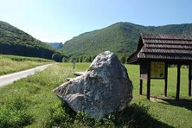
Muránska planina National Park (Slovak: Národný park Muránska planina) with a total area of 203.18 km², is one of the youngest national parks in Slovakia (since 1997). It is situated in Central Slovakia, in the districts of Brezno and Revúca, in the Banská Bystrica Region. It protects the area of Muránska planina (Muráň Plateau), which is geologically part of the Slovenské rudohorie mountain range.
The core of the park consists of the limestone and dolomite plateau with karst formations. The overall length of karst landscape from the settlement of Červená Skala (part of Šumiac) to the town of Tisovec is about 25 km.
There are more than more than 300 caves, which are inaccessible to the public and 15 abysses. The highest point is Fabova hoľa at 1,439 m AMSL, however, a higher peak, Stolica at 1,476 m is located in the buffer zone. Its terrain is refreshed by sink holes, grikes, canyons, rock towers, and rock windows.
Forests cover about 90% of the area.
Tourist attractions include 300 km of marked hiking trails and two educational trails. The best access to the park is through the surrounding villages and settlements, like villages Tisovec, Muráň and Červená Skala. Attractive places for hiking also include Závadka nad Hronom and saddleback Zbojská.
View Muránska planina National Park in Slovakia in a larger map
Category: National Parks, National Parks, Slovakia


